A reliable supply of reasonable quality water was essential for people engaged in agriculture and living in country areas. With “The Grange” farm property being more than a mile from the Liffey River and no natural storages being located on the farm, the early pioneers had to employ other ways of providing a water supply.
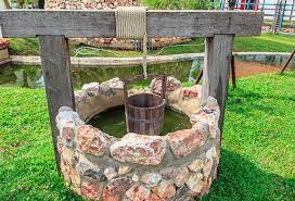
At Bishopsbourne, Tasmania as in other regions, this was achieved by the digging of wells which are numerous throughout the district, with the Mines Department map recording 27 wells within a one mile radius from the cross roads in the Bishopsbourne township. Some of these are still being used. The wells vary in depth, this dependent on the distance down to reach the underground stream being aimed for. Some of the wells are as shallow as 12 feet with several being up to 90 feet deep with the majority being from 30 to 45 feet deep. One of the 90 feet wells is located on the hill to the east of the “Sunny Rises” property at Green Rises. Athol Richardson tells that those who have descended to the bottom, advise at that depth, even in the middle of the day, can see the stars shining.
The wells throughout the region are brick lined and Dad (Eric Badcock) would relate that when lining a well one of two methods would be employed. One was to dig the well, shore up the sides to prevent cave ins, and then brick up from the bottom, with the second method being to brick down as the well was being dug. When this latter method was employed, a suitable sized cart wheel rim or similar would be used, the bricks being laid around the rim and allowed to descend by digging from underneath.
At “The Grange” on the original holding of 272 acres, only one well was to be found, located about 20 yards from the back door of the house on the southern side. On the 95 acres later purchased and adjacent to the township, two wells are to be found, a shallow well on the bank to the south of the former Seventh Day Adventist church and which mostly went dry during the summer months, with the second being located in what we knew as Curtis’ yard over the road from Keith’s house property, originally the “Bush Inn”. However this well was not often used, it being in a damaged condition with part of the brick lining having collapsed.
The well at Dad and Mum’s (Eric and Elma Badcock) farm house was about 30 feet deep with the water being fairly hard in quality. In wet winter months it would sometimes overflow, while in the dry summer months would make just over a hundred gallons a day at minimum, somewhat less than the well adjacent to our cottage which would make 300 to 400 gallons a day.
The water from the well was mostly used for stock watering, the garden and occasionally for bathing when the tank supply was low. When I first remember a windless stood over the well, with Dad winding the water out in a fairly large metal well bucket and tipping the water into a nearby wooden trough, which had been made by hollowing out the trunk of a tree.
Always an interest for us children was to look for frogs brought up from the depths in the bucket, these mostly consisting of two varieties, one large and green and the second, fawn in colour and much smaller. Later in the 1950’s a 30 foot windmill was installed over the well and frogs were no longer brought to the top, but it did save Dad a lot of time and effort in winding water.
A secondary use for the well before refrigeration was, in hot weather, the cooling and storage of recently killed and dressed sheep. The carcass would be wrapped in a clean cloth or placed in a bag and lowered down the well where even on the hottest day the temperature was much cooler and flies did not reach. When the meat was sufficiently set it would be lifted out and cut up.
An interesting story concerning a well at “Stratheden” comes from the time when the Campbell family owned “The Grange” and the “Stratheden” properties. Dad would recall that their fences were generally in poor condition and with the township cows mostly being run on the roadsides, they frequently broke into the Campbell’s paddocks and growing crops. On one of these occasions, Ken in frustration and with some arrogance, rounded up the cows and had them impounded. In retaliation the township people took his plough and dropped it down a well near his “Stratheden” home. It was only after several months of searching and enquiry that Ken located his plough and retrieved it.
A well that featured in another story concerned that located on the nearby “Lonsdale” property. For a time the McQueen family operated the property and it is said that on several occasions when milking their cows in the open at night, they saw a light move across the yard close by and disappear down the well. The sight was sufficient to generate enough fear to cause them to drop their buckets and run.
At “The Grange” with the well being so close to the house, the danger of us children falling in and drowning was a constant worry to Mother. Consequently the top was kept well covered with strong timber and as a further safety measure several heavy rocks were placed on top. Playing on top of the well was strictly forbidden, although when Mum and Dad were not in sight we would sometimes go to the well and through the cracks, drop pebbles and listen for the returning splash sound.
The water trough was also the source of some enjoyment, not only for the watching of the frogs swimming and leaping, but also for the sailing of boats. When eight or nine years of age I was given a sailing boat for Christmas which together with a number of boats that I made and equipped with sails and rudders, were regularly sailed in the waters of the trough. At times quite an armada was assembled and with sails and rudders set at various angles, in the wind they were pushed in many different directions.
As the land became cropped out and stock and wool prices improved, the paddocks were sown down to pasture and the sheep and cattle numbers built up. However with the increased demand for water the well was found to be inadequate and the necessary water was frequently obtained from a well at Uncle Trevor’s cottage or sometimes known as Viney’s place, an earlier tenant farmer. Dad would regularly load the sledge with up to half a dozen open 44 gallon drums and drawn by a horse and later the tractor, make his way to the well and fill the drums. To stop the drums slopping hessian bags were placed over the tops and tied with ropes. They were then carted the near mile to home or to various paddocks where the stock were being run and bucketed into half 44 gallon drums.
Water Holes
To overcome the water shortage and to save time in carting, during the 1950’s most farmers, including Dad, installed a number of small farm dams at various places on their farms. These were positioned to catch winter run off water and with them being dug into good quality clay, provided reliable storage. Many of these dams were dug by a neighbour, Mr. Gilbert (Tabby) Walker.
However when the dams became low the cattle would walk into the water to drink and with the clay being soft would soon bog the area making them dangerous, particularly for weak and young cattle. Therefore when the dams became low regular inspection was necessary. I recall going to the dam to the west of the house one Sunday morning when going to fetch the cows for milking and there found four cows stuck in the clay with two already having drowned. Dad came with the tractor and ropes and after some effort got all four from the mud. The two survivors could not get on their feet so we got a wooden gate and in a sledge position rolled the cows onto it and one by one, sledged them home where with care, both recovered.
On occasions to prevent the stock getting to the dams and stuck, Dad would fence them off and water them from other points.
To provide greater and safer storage most of the dams were later increased in size with quite a large storage dam built about a hundred yards to the north of the house. An electric water pump was installed at the same time with the pipe line going as far as the tubs near the well and later when the large circular cattle trough was built in the yard near the dairy, extended to that point. This was after some years, further improved with the installation of a pressure system and as well as watering the stock, was used for the garden, house toilet and in the dairy.
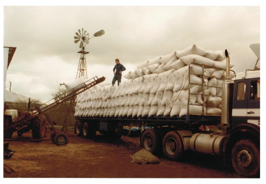
In the late 1970’s a channel of the Cressy-Longford Irrigation scheme reached the farm bringing good quality water from the Great Lake and was of great assistance in not only providing a reliable supply of water, but also the opportunity of growing a range of different crops with much more certainty of success.
Bores
From the 1960’s a number of bore holes were drilled in the Bishopsbourne area with two being drilled on “The Grange”. These were at the instigation of farmers seeking water, the Mines Department doing a general survey and several parties searching for oil, gas and minerals.
One of the earliest bores and which created a considerable amount of interest was that drilled around 1968 by Mr. Charlie Sulzberger on Uncle Jeff’s “Meadow Bank” paddocks, when he was particularly looking for oil and gas. It was his strong belief that oil existed in the area as the geological maps indicated that the Bass Strait oil basin extended to the area. He got down to about 2,300 feet where on striking dolerite rock, broke off his drilling bit. Terry and Tony Badcock, Uncle Jeff’s sons, helped on the rig during the drill. On the way down the drill encountered 90 feet of clay, 80 feet of white puggy type material before dropping through 80 feet of water, sea sand, layers of timber and at around a thousand feet and beyond, seams of low quality coal and at around 2,000 feet, a four feet thick seam of high quality coal. With Charlie’s equipment not being good enough to penetrate the dolerite he finally gave up the effort even though he was convinced that oil did exist below the dolerite rock.
Charlie also had some skills at divining and believed that a half mile long reef of gold at about 600 feet down was present on the nearby bank and planned to return and investigate after drilling several other planned oil wells, but this was never undertaken.
At around the same time the Tasmanian Mines Department conducted a drilling programme in the region concentrating their efforts in an arc around the Great Lake. Around late 1968 when milking at “The Grange” while Dad and Mum were on the Mainland, Mr. Lloyd Matthews a member of the drilling team called at the farm and in discussion said that they were particularly looking for an underground river which they believed was flowing from the Great Lake. Most holes were drilled to about 250 feet with several extending to 600 feet. I never heard that the river was located but it may well be the underground river that empties into the Tamar River at Fresh Water Point.
From the extensive drilling that has occurred in the area it is apparent that there is a considerable amount of underground water throughout the area with Dad investigating their possible potential for use on the farm.
Around 1972 the Getty Oil Development Company conducted a drilling programme throughout the region when they were searching for uranium. Some uranium was found in the Jockey paddock bore hole and in several bores to the west, but the mineral was not in commercial quantities. A second hole was drilled on “The Grange” on the southern edge of Curtis’ yard just below the Bishopsbourne township.
Listed below are details of materials intersected in the two rotary drill holes as advised in their letter of 18th. January, 1973
“Hole T/5 (southernmost hole). This was near the northeastern corner of the paddock)
0 – 60ft. light grey to yellow brown CLAY
60 – 290ft dark grey brown, carbonaceous CLAY
290 – 310ft dark brown and light grey silty CLAY – interbedded
310 – 330ft SILTY SAND
330 – 340ft COURSE SAND
340 – 410ft SANDY SILT with bands of dark brown CLAY
410 – 450ft SILTY SAND with bands of dark brown CLAY
In this hole the zone 310ft. – 340ft. probably offers best prospects as regards water production.”
“Hole T/6 (in pea paddock near Bishopsbourne village)
0 – 53ft light grey to yellow brown CLAY
53 – 260ft dark grey brown, carbonaceous CLAY
260 – 275ft SANDY SILT
275 – 290ft fine grained SILTY SAND
290 – 320ft medium to course grained SAND with minor SILT
320 – 400ft dark brown CLAY with bands of grey SANDY SILT
In this hole the zone 275ft. – 320ft. probably offers the best prospects.”
Dad also had the water analyzed and a letter dated 21st. December, 1972 from the Department of Mines – Tasmania gave the following details:-
“The sample of water from a bore on your property at Bishopsbourne has been examined with the following result:-
TDS. 160-200 mg/l
Ca 3 do.
Mg 7 do.
Cl 98 do.
pH 5.8
This water does not contain a great deal of dissolved solids (TDS). The chloride at 98 is relatively high and it is somewhat acidic (pH 5.8, neutral is 7.0).
Unless the peas are susceptible to chlorine at this level, I would think the water is suitable.”
From the drill tailings a blue coloured rock was found present which Dad also sent away to the Mines Department for analysis with the following result being received:-
“A small specimen of a blue mineral submitted by you to the Chief Chemist & Metallurgist, Launceston, has been examined and determined as the mineral vivianite, a hydrated phosphate of iron.
The mineral has no particular commercial value.”
Last updated by Ivan Badcock 09/03/02
It’s interesting to know the history of water bores and how the process is supposedly used to look for oil and gas. Today, it is one of the most crucial processes to look for water that can be very beneficial for farms. I wonder how the services of today evolved to make boring more efficient.